Showing posts with label maps. Show all posts

Friday, September 20, 2013

Weekly Map News

This Week in Maps

Sharing your one-stop list for interesting mapping, geography, GIS, and cartography news, articles and new maps!

Atlas of True Names - Find the literal meaning of any location! USA and Canada atlases released this year.

This is Your Brain on Maps - Humorous article showing how distorted the human head looks on popular map projections. A powerful example of the difficulties of displaying a 3-D globular object on a 2-D space.


'Squatch Watch: 92 Years of Bigfoot Sightings in the US and Canada - Mapping Bigfoot Sightings, Joshua Stevens finds a correlation between high sightings and low population that narrows down possible locations...mapping fun, even if you don't believe in Bigfoot!

Sea Monsters: A Voyage Around the World's Most Beguiling Map - A fantastical exploration of bizarre and imaginary creatures, by Joseph Nigg, published by University of Chicago Press last month.


Thursday, August 29, 2013

Mapping Canada’s Mineral Resources

With Beautiful Landscapes & Wall Maps of Canada

Lake Louis, Alberta, Canada from Piriya Photo


Geo-Mapping is the Key to Mineral Opportunities in Canada's North
GEM is the Geo-mapping for Energy and Minerals program, recentlyrefunded to facilitate exploration activities in Canada’s North.

Why are Mineral Resources so Important?
Canada’s mineral resources include gold, diamonds, copper, zinc and lead among others. The mining sector is proportionally the largest private sector employer of Aboriginal peoples in Canada, and employment is poised to increase (Exploration and Mining Guide toAboriginal Communities).

Canada Physical Wall Map
This Canada Physical Wall Map features lakes, rivers, mountain ranges with a range of colors. 
Mapping Canada’s Mineral Resources
Canada is the number 1 destination for mineral exploration on the planet since 2006. Like Canada’s neighbor, Alaska (which we explored in Alaska's Frontiers: Mapping Strategies for Mineral Resources), Canada is abundant in mineral resources, but largely unmapped. Mapping these key resources will show the best locations for mining and minimize environmental impact.

1978 Vintage Canada Wall Map
British Columbia, Alberta and Yukon Wall Map 1978 Wall Map
The Future: Looking at the Past on Wall Maps of Canada
National Geographic’s 1978 take on Canada as “Beauty to Flaunt and Bounty to Grown On” on this vintage Canada Wall Map shows that the vast resources of Canada were enviable several decades ago as well. As time goes on and development continues, unexplored areas become more desirable and even more important for further development.

Pingualuit Crater, Northern Canada

Thursday, June 27, 2013

DIY Map Crafts: Beautiful Map Artwork and Do-it-Yourself Map Crafts

Here are some of the best map crafts we've seen around the web lately. If you follow us on pinterest, you can find even more map do it yourself crafts and art.

There’s no limit to what you can do with maps. Already graphically engaging and informative, maps lend themselves well to incorporation or inspiration in all kinds of art. Artists render their own maps using an outline as a starting point, or cut, paste and overlay maps for visual interest. We love what these artists have done with maps!


DIY Quilled Map Craft Art
Like this beautiful quilled map by Amber Rousse. You can tell she spent many hours perfecting each quill. The land even has mountains! Now that’s a three dimensional map!

DIY Clock Map Craft
We love this DIY map clock, it’s beautiful and inexpensive! The materials? Clock workings, a round tin plate and a map. You could do this with any map, or get a custom map printed just for you!

DIY Map Wallpaper Craft
Create a wall full of maps! Your own unique map wallpaper of the places you been, and/or where you dream to go one day! We love this example of DIY map wallpaper. You can take any maps, old, new, vintage, antique and artistically design your own world.

DIY Map Embroidery Hoop Craft
Simple and elegant, these vintage maps are craftily displayed in wooden embroidery hoops. Similarly, you could use maps of any location and any style to achieve this look. Reminds me of maps with wooden rails because they have this vintage feel to them!


DIY Wedding Gift Map Location
A beautiful wedding gift. This map could represent the location and date of the wedding, where they met, or the location of the proposal. If you’re not a designer, you can get a custom map made with the location marked and the names printed in any design, of any location!

I hope you felt inspired and not intimidated by all this beautiful DIY map artwork! And, if you don’t have crazy amounts of time or the will to stay up all night and craft with maps, you can always go to mapsales.com and shop for beautiful paper, laminated, framed and magnetic maps of all sizes (even large enough to cover an entire wall!). Or call and have a map custom designed just for you!

If you read all the way down to here, you probably liked this article...so share it with your friends!

Thursday, May 2, 2013

How To Get Permanent Marker Off Laminate Maps

Did you accidentally use a permanent marker on your laminated map? Don't give up! Try this for a quick fix!

"I swear it said Dry Erase!"

1. Take a regular dry erase marker and mark over the permanent mark, completely covering it
2. Wipe off the marks as usual with a dry eraser or cloth.

That should take the permanent marker on your laminated map (or poster!) right off!

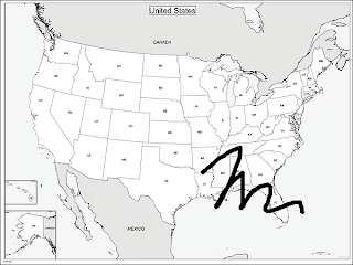
Just as Good as New, USA Outline Wall Map!

Tuesday, February 26, 2013

New Maps Show Worldwide Coral Bleaching by 2056 - Global Warming?

In a study funded by Pacific Islands Climate Change Cooperative, new maps show the potential effect of worldwide coral bleaching by 2056.

Corals in Polynesia

The mass bleaching is caused by higher-than-normal sea temperatures. Light kills the algae that reside within the corals, giving them the bright colors as well as nutrition. The findings of the study emphasize that without significant reductions in emissions, most coral reefs are at risk.

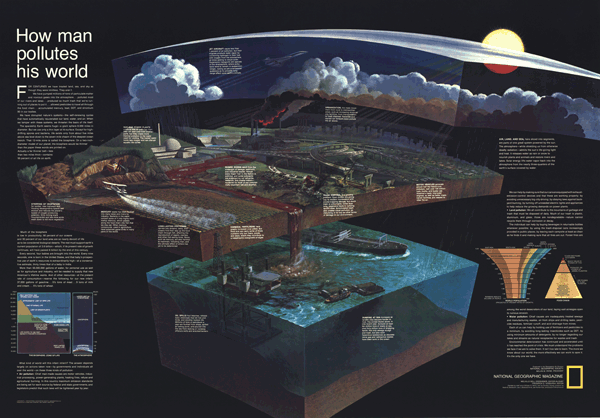
The maps utilize spatial variability, showing the effect of temperature increases on a global scale. This temperature increase (also called Global Warming) could be the result of human development, industrialization and pollution. This wall map, How Man Pollutes His World, published by National Geographic, shows how everything we do affects the environment.

How Man Pollutes His World Wall Map
The use of maps illustrate the point that the world is changing – and quickly! What will the world look like in 2056? How will the bleaching of coral reefs affect the ocean ecosystems in those areas? Using geospatial technology allows us to not only collect, analyze and compare large amounts of data, but also make predictions about how the world will change. Maps help us explore and understand our world, after all, we only have one Earth.

Thursday, February 21, 2013

Is GIS the Future? Prepare for New Jobs with Educational Wall Maps


GIS stands for Geographical Information Systems, systems designed to capture, manipulate, and present all types of geographical data. It combines technology, geography and data in ways that are quickly changing all aspects of life and how we approach the world. But are our children prepared to become the experts in this field? mapsales.com takes a look at the future job report, GIS innovations and educational wall maps to find out.

Recently in the news, we’ve heard reports about GIS being used to help fight crime in New York, Los Angeles and now Australia. The UN recently promoted the use of GIS in disaster risk reduction, preparedness and emergency response. All of these new innovations mean that GIS is an emerging sector of the workforce.

More jobs are a good thing, right? Not if Americans are ill-equipped to fill those positions.

In this letter to Congress, a former teacher urges everyone to support the Teaching Geography is Fundamental Act. He explains that “There is an enormous demand in both the public and private sectors for people with the ability to interpret and analyze geographic data. There are 70,000 new jobs in geospatial technology each year, but we are not training Americans to fill them.”

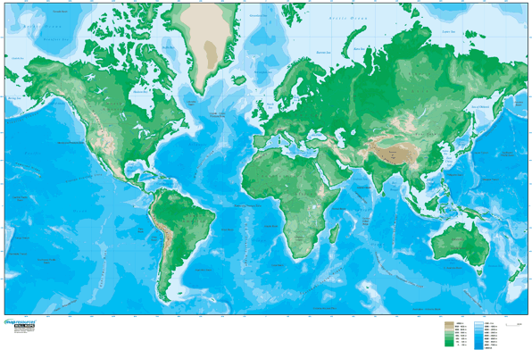
Educational Wall Maps - World
It is important to educate young Americans in the way that will best prepare them to take over governance of the USA. This includes immersing children with educational wall maps, and encouraging them to have an opportunity to become interested in the world. Most importantly, starting to do so at a young age. Think about encouraging geographical skills that could help the world and shop by grade level for Educational Wall Maps.

Do you agree that GIS will be the way of the future? How should we prepare our children for a technological world?

Thursday, February 7, 2013

Digital Maps Versus Paper Maps


There’s a lot of media buzz recently about not only how amazing digital maps are, but also their failings. Do we rely too much on digital maps? mapsales.com takes a look at how technology has improved the usability of paper maps as well.

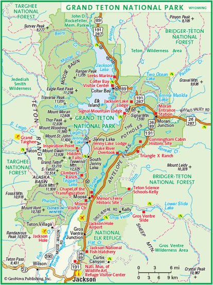
If you’re worried about bad weather affecting your paper maps while hiking or skiing, invest in synthetic paper maps. For example, while testing out Google’s Ski Resort coverage at Jackson Hole Mountain Resort, you can also take this Grand Teton National Park Map to check out the trails, museums, and other points of interest, without worrying about wear and tear or water stains.


Today we might still recognize the motif of a man refusing to ask for directions, poring over a large paper, fold-out map. That motif may well become obsolete. Our digital devices give a (mostly) precise description of our location and (mostly) correct directions to wherever we’d like to go, even speaking the directions so we don’t have to consult the on-screen map.

However, what happens when technology fails? Apple maps are the most well-known example of this failure, leaving a group in Australian stranded in a national park 40 miles away from their destination. Smaller mistakes do occur, as well as the very real possibility of running out of battery power.

The fact that, as Christine Ortiz notes in Why Digital Maps Aren’t Ready to Replace Paper, military personnel still prefer to consult paper maps, says a lot about the benefit of keeping a paper map backup in your car or backpack. This may be especially handy in areas where satellite coverage is sparse, with maps of the rural areas or National Park Wall Maps.

Check out more wall maps at mapsales.com.


Tuesday, February 5, 2013

How Businesses use Demographic Data To Increase Sales and ROI


US personal income rose 2.6 percent last month, the largest increase in eight years, according to the Commerce Department. Although tax increases are due to start this month, the increase is still well above the 0.8 percent expectation. How do businesses use income information to increase their own sales and ROI? They look at a demographic map.

Census.gov features tools to visualize certain census data. “Islands of High Income” is an interactive map showing median income across the US. Viewers move the sliders to see counties of the US that have median household income greater than any increment between $18,000 and $110,000. However, data sources are from 2006-2010, so the visualization is a very general overview of the state of median household incomes across the US.


Businesses looking for up-to-date and more accurate data usually have to do the work themselves. With new technology, it’s becoming easier and easier for businesses to receive up-to-date data and maps.  Demographic Wall Maps of any County, State, or custom area in the US show population, median household income, number of households and median age within that area.

Businesses use these maps to understand their target markets in their areas, targeting areas with a certain income level or of a certain age group to increase sales. They add sales and order data to understand where their customers are already located. 


Using demographic data is not only for large businesses with an expert dedicated to geographic information systems (GIS); mapping data is becoming more affordable and easier to use in various formats. A map, report or interactive web application are some of the different ways everyday business analysts or owners are using demographic maps to increase sales!

Thursday, December 27, 2012

University of California Berkley Auctions Off Historic Map Collection

Earlier this month, the geography department at UC Berkeley auctioned off its sizeable map collection.  mapsales.com takes a look at some of these historic maps. 


Although modern maps have gone the way of computerized images and digital applications, there is nothing quite like an antique map that you can hold in your hands.  Hand-drawn maps are becoming rare pieces of cartographic art.  If you were lucky enough to be in Northern California’s Berkeley area this December, you could have gotten your hands on some rare and historic maps. 

University of California Berkeley’s geography department held its map auction on December 15, selling off its historic collection of state, city, topographic, water table, and country maps.  The maps sold from 50 cents to $5. 


According to Dan Plumlee, manager of the department’s map collections, space is a big reason for the sale.  There is simply not enough room to hold the large map collection.  And while geography students as well as department faculty still use physical maps, the ones marked for sale were either redundant or rarely used. 


The biggest sellers of the day were topographic maps (maps that display elevations of a specific area).  Topographic maps are used by researchers and teachers, as well as hikers and architects. 

Want to learn more about historic and antique maps? Contact us!  mapsales.com carries over 200,000 wall maps…delivered as fast as next day!