Showing posts with label antique map. Show all posts

Wednesday, July 31, 2013

Why Is North Up on Maps? Upside Down Maps Break Conventional Perspective

Why Is North Up on Maps?

We see it everyday, even on google maps: North is at the top, up, above on most 2-dimensional depictions of the world. But why is north up on maps so often that countries become unrecognizable when show 'upside down'?

Maps Throughout History

Throughout history, the orientation of maps has actually changed more than you might have assumed. In medieval Europe during the crusades, Jerusalem was positioned at the top of the map, putting East at the top. This alignment to where the sun rose helped give us the word ‘orient’.

Arabic maps placed south at the top. Possibly because when one wakes up to face the sun, south is on the right (right having a positive connotation).

In the west, the tradition of orienting maps to the north began with the 5th century Alexandrian geographer Claudius Ptolemy. Ptolemy’s work, the Geographica, is considered the first known geography. Ptolemy was familiar with Polaris, the North Star, and in order to encapsulate his known world and celestial space, he chose to make north up on maps.

antique world map explorers

North-South Up-Down Concept Affects Perceptions

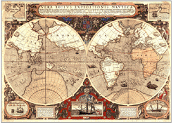
Similarly, as explorers continued on the quest to map the world in later centuries it was easier to start a map at the top, with the area explorers were most familiar with: the Northern hemisphere. Writing location names and notes in this orientation discouraged the turning or rotation of maps so north remained up on maps.

The orientation of maps is reflective of and has an effect on our perception of the world. We often think of space in the form of ‘above’ and ‘below’ according to the North is Up perspective on most modern maps. That city is ‘below the river’. The United States is ‘above Mexico’ and ‘below Canada’. Australia is known as the ‘land down under’. Although literally ground is below and sky is above nearly any given location, because maps have taught us that north is up and south is down, we talk about places in this way.


View The World From a Different Perspective on Upside Down Maps

Upside down maps force us to view the world differently. When we see south at the top of the map and north at the bottom, we may notice new things about the world. For instance, on an upside down map it is easier to notice:
  • most of the land mass of the world is concentrated in the northern hemispheres
  • South America is more south-east than directly south of North America
  • Europe appears less significant ‘below’ the large continent Africa
If you read this entire article you must have liked it. Please share using one of the buttons below, thanks!

Tuesday, February 12, 2013

Planning a Cruise? Carnival Cruise Ship Stranded

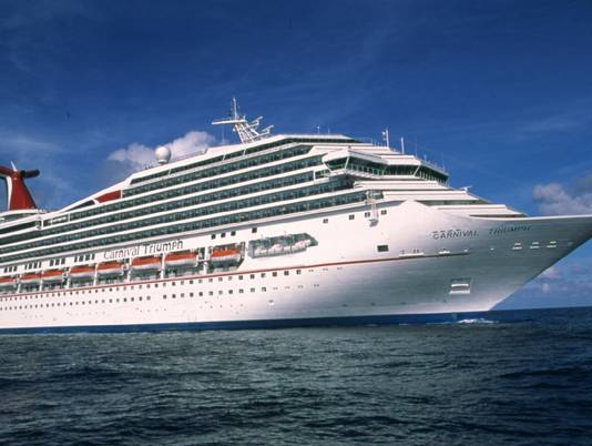
A fire on Sunday debilitated a Carnival Cruise Ship in the Gulf of Mexico. More than 4,200 people are on board without power or plumbing. Two tugboats will be required to tug the larger-than-Titanic Carnival Triumph. The ship had drifted north and is expected to arrive in Mobile, Alabama on Thursday. Until then, other ships have brought much-needed supplies.
Zoom in to find Mobile, Alabama on this Countries of the Caribean Wall Map

Because of plumbing issues, many passengers are sleeping in the hallways or on the deck. With limited access to bathrooms, food and hot coffee, passengers are forced to simply wait it out until they get tugged to port.

Cruises are a popular type of vacation. For the ticket price, a passenger gets pampered while visiting different countries or islands. While passengers may brave getting off the ship to explore different ports for a period of time, they are able to return to the ship in time to enjoy a lobster dinner and hot tub soak. For those unwilling to trust flights, foreign hotels or food, it is a way to safely explore some of the world.

Take a cruise or backpack in the wild?

However, many people commenting on the yahoo.com top stories report who have plans to travel on a Carnival cruise later this year are debating or flat-out stating that they will cancel their cruise. We may see a decrease in cruise ship vacation popularity. Perhaps we will see an increase in other types of travel vacations, traveling by flight or car with visitors venturing farther into foreign countries, beyond the tourist-geared ports. When planning your vacation, be sure to ask around, explore some maps, and research your location first!

This Antique Countries of the Caribbean Wall Map shows the Gulf of Mexico with shipping lines. Zoom in to find where the Carnival Triumph will be towed: Mobile, Alabama.

Which would you rather do: take a cruise, or backpack in the wild?

Wednesday, January 23, 2013

Bizarre Fire at Chicago Warehouse in Icy Weather

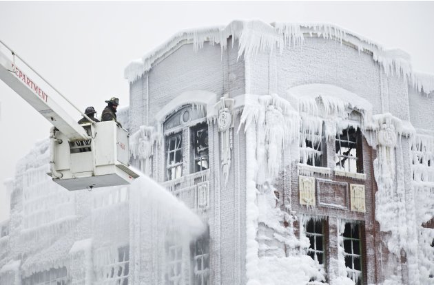
Last night, an abandoned Bridgeport warehouse caught fire, starting the largest Chicago fire in seven years. mapsales.com takes a look at the bizarre photos of the massive fire in icy temperatures.


The blaze was spotted shortly after 9 p.m. Tuesday evening. The fire department called extra alarms as the fire spread quickly through the warehouse and the roof collapsed. The bitter cold weather worked against them as over 200 firefighters contended with the massive fire as well as heavy ice on fire hydrants, hoses and ladders.


"Everything is wood inside these buildings, beautiful façades on the outside. They've been up for a long time. When they start burning like this, they start coming down," Chicago Fire Cmsr. Jose Santiago said.


Working against the frigid temperatures and building ice, the fire was finally brought under control around 12:30 a.m. Firefighters were still spraying down hot spots early this morning.


Chicago is remembered for the historic fire of 1871, one of the largest US disasters of the 19th century. A disaster which led to the rebuilding of Chicago and it’s emergence as one of the most populous and economically important American cities. See this transformation depicted in a 1916 Chicago Antique Wall Map, which shows a populous and thriving city forty years after the fire.

Perhaps the Bridgeport fire will allow rebuilding of the abandoned warehouse into something new and inspiring.

Thursday, December 27, 2012

University of California Berkley Auctions Off Historic Map Collection

Earlier this month, the geography department at UC Berkeley auctioned off its sizeable map collection.  mapsales.com takes a look at some of these historic maps. 


Although modern maps have gone the way of computerized images and digital applications, there is nothing quite like an antique map that you can hold in your hands.  Hand-drawn maps are becoming rare pieces of cartographic art.  If you were lucky enough to be in Northern California’s Berkeley area this December, you could have gotten your hands on some rare and historic maps. 

University of California Berkeley’s geography department held its map auction on December 15, selling off its historic collection of state, city, topographic, water table, and country maps.  The maps sold from 50 cents to $5. 


According to Dan Plumlee, manager of the department’s map collections, space is a big reason for the sale.  There is simply not enough room to hold the large map collection.  And while geography students as well as department faculty still use physical maps, the ones marked for sale were either redundant or rarely used. 


The biggest sellers of the day were topographic maps (maps that display elevations of a specific area).  Topographic maps are used by researchers and teachers, as well as hikers and architects. 

Want to learn more about historic and antique maps? Contact us!  mapsales.com carries over 200,000 wall maps…delivered as fast as next day!