Showing posts with label history. Show all posts

Friday, November 15, 2013

Fun and Educational Wall Maps: Gifts for Kids

Looking for the perfect gift that is both fun as well as educational? We've picked out the top educational wall maps as perfect gifts for kids this holiday season! Give the gift that looks awesome on their bedroom wall and is a useful tool for homework reference and exploring the world! Educational wall maps are available for every grade level and age.


Cindy is halfway through first grade. We’re choosing a colorful World Deluxe Political Wall Map with protective lamination. We used poster putty to adhere the laminated wall map close to the ground, next to her coloring table. She has special dry erase markers she can use to decorate the world wall map.


Jennifer is in the fifth grade. She has a big test at the end of the year in which she has to write down every state and its capital by memory. The US Flags Wall Map has more than enough information to help her study! We recommend the US Wall Map with wooden rails so the map can be pulled down and revealed for study time.

Abraham is entering high school next year. He’s already into WWII weapons and machinery, so the World War II Europe Wall Map is the perfect choice for his interests as well as his World Cultures Class. We choose the magnetic wall map so he can track the location of troops as he reads more about the war.

Find Wall Maps for Kids


Friday, September 27, 2013

Map News: This Month’s Best Articles and Maps

I've scoured the web for the most interesting Map News this month for all you map-lovers!

Map Comic this month from Savage Chicken


New Maps of Alaska: : New mapping data changes what we know about the landscape of Alaska, with some data that hadn’t been updated for 50 years! The results? The highest mountain in North America, Mount McKinley, is shorter than previously thought…Read More

Even with a GPS, You Can’t Get There From Here: Join us on a road trip through Maine, where getting lost with a GPS is painfully easy. Get your paper maps ready for visiting the rural portions of the USA…Read More

Where is the Center of Each United State? And why would you care to know? Some interesting and some funny insights…Read More

What Did the Continents Look Like Millions of Years Ago? Features an interview with artist-geologist Robert Blakey. This article goes into serious depth and really shows the making of these astounding maps in detail. The comment section is pretty interesting as well!…Read More

Facts for Features: Halloween: Did you know the Census Bureau publishes a series on dates and holidays? It boosts interesting facts gathered from all over the immense census database. For example, 47,800 acres of pumpkins were harvested in the US in 2012! Read More Halloween Facts

Did you enjoy reading these articles as much as we did? Use the buttons below to share them with your friends!

Wednesday, July 31, 2013

Why Is North Up on Maps? Upside Down Maps Break Conventional Perspective

Why Is North Up on Maps?

We see it everyday, even on google maps: North is at the top, up, above on most 2-dimensional depictions of the world. But why is north up on maps so often that countries become unrecognizable when show 'upside down'?

Maps Throughout History

Throughout history, the orientation of maps has actually changed more than you might have assumed. In medieval Europe during the crusades, Jerusalem was positioned at the top of the map, putting East at the top. This alignment to where the sun rose helped give us the word ‘orient’.

Arabic maps placed south at the top. Possibly because when one wakes up to face the sun, south is on the right (right having a positive connotation).

In the west, the tradition of orienting maps to the north began with the 5th century Alexandrian geographer Claudius Ptolemy. Ptolemy’s work, the Geographica, is considered the first known geography. Ptolemy was familiar with Polaris, the North Star, and in order to encapsulate his known world and celestial space, he chose to make north up on maps.

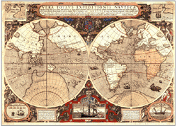
antique world map explorers

North-South Up-Down Concept Affects Perceptions

Similarly, as explorers continued on the quest to map the world in later centuries it was easier to start a map at the top, with the area explorers were most familiar with: the Northern hemisphere. Writing location names and notes in this orientation discouraged the turning or rotation of maps so north remained up on maps.

The orientation of maps is reflective of and has an effect on our perception of the world. We often think of space in the form of ‘above’ and ‘below’ according to the North is Up perspective on most modern maps. That city is ‘below the river’. The United States is ‘above Mexico’ and ‘below Canada’. Australia is known as the ‘land down under’. Although literally ground is below and sky is above nearly any given location, because maps have taught us that north is up and south is down, we talk about places in this way.


View The World From a Different Perspective on Upside Down Maps

Upside down maps force us to view the world differently. When we see south at the top of the map and north at the bottom, we may notice new things about the world. For instance, on an upside down map it is easier to notice:
  • most of the land mass of the world is concentrated in the northern hemispheres
  • South America is more south-east than directly south of North America
  • Europe appears less significant ‘below’ the large continent Africa
If you read this entire article you must have liked it. Please share using one of the buttons below, thanks!

Thursday, July 25, 2013

Master List of Map and Geography Jokes!

mapsales.com has searched the web far and wide for the best map jokes. We’ve included funny geography jokes and travel jokes as well. Whether you are taking a family trip or teaching students about geography, map jokes can break the ice and get children and adults conversing about places around the world, geography and maps!

Enjoy these funny map jokes!

Q. What do John Wayne and a map key have in common?
A. Both are legends.

Q. Why do paper maps never win at poker?
A. Because they always fold.

Q. What did the mapmaker send his sweetheart on Valentine’s Day?
A. A dozen compass roses.

Q: What always sits in the corner but can move all round the world?
A: A stamp!

Q: Why is it easy to get into Florida?
A: Because there are so many keys.

Q: What is round at each end and high in the middle?
A: Ohio.


Q: What did the sea say to the shore?
A: Nothing, it just waved!

Q: What do fish and maps have in common?
A: They both have scales!

Q: What kind of maps do spiders make?
A: Web-based maps!

Q. What is smarter, longitude or latitude?
A. Longitude, because it has 360 degrees

Q. Why does west longitude need to be cheered up?
A. Because it is always negative.

Q. What map element plays in the band?
A. The symbols (cymbals).

Q: What’s a map favorite type of syrup?
A: Map-le syrup!

Q: Where do fish keep their money?
A: In riverbanks.

Q: Where is it always 90 degrees, but never hot?
A: The North and South Poles.

Q: What do you get if you cross a farm animal with a map maker?
A: A cow-tographer!


Q: What rock group has four men that don't sing?
A: Mount Rushmore!

Q: What would you get if you crossed a river and a desert?
A: Wet and thirsty.

Q: Who is the coldest relative on earth?
A: Aunt Arctica.

Q: What's the coldest city in Germany?
A: Brrr lin (Berlin).

Q: Where can you find lots of shoes?
A: In the foothills!

If you liked these map jokes, share them with your friends!

Thursday, May 9, 2013

The Best Wall Map Ideas for the Home

Ever see those beautiful maps on Pinterest and wondered where to buy them and how to decorate with maps? We've scouted out some beautiful wall map decor ideas for the home, and how you can get the same maps!

Bold USA Wall Map for the Bedroom


This USA Wall Map looks great over a master or guest bed. The blue, red and yellow primary color scheme is consistent throughout the room. Following the color scheme in a map is an easy way to make design choices for a room!

We found where to buy this USA Executive Wall Map below!
USA Executive Wall Map
Get this USA Executive Wall Map!


A Wall Map Across the Entire Wall


This room is one of our favorites, and it's popular on pinterest as well! The white and brown color scheme allows the blue of the beautiful oceans to really pop.

I just imagine having an intimate dinner here with friends just back from vacation. We'd be able to see exactly where they'd gone on this map! And, we found this same Political Wall Map for sale online. You can get it as large as 9x12 feet!
Political World Wall Map


Unusual Thematic Wall Maps for Modern Decor


This wall map hangs over the bed with wooden railings. Just like an old vintage classroom map!

The stark white combined with bright pops of color add life to the room. The hanging lights draw the focus further to the focal piece of the room, the World Climate Wall Map! This unusual wall map features bright bold colors for a modern design.
World Climate Wall Map
World Climate Wall Map Available on Spring Rollers
If you read this article to the end, you probably liked it, please share it with your friends using the buttons below!

Tuesday, February 26, 2013

New Maps Show Worldwide Coral Bleaching by 2056 - Global Warming?

In a study funded by Pacific Islands Climate Change Cooperative, new maps show the potential effect of worldwide coral bleaching by 2056.

Corals in Polynesia

The mass bleaching is caused by higher-than-normal sea temperatures. Light kills the algae that reside within the corals, giving them the bright colors as well as nutrition. The findings of the study emphasize that without significant reductions in emissions, most coral reefs are at risk.

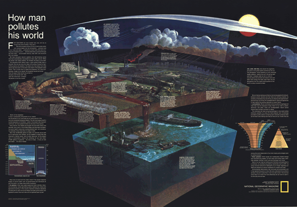
The maps utilize spatial variability, showing the effect of temperature increases on a global scale. This temperature increase (also called Global Warming) could be the result of human development, industrialization and pollution. This wall map, How Man Pollutes His World, published by National Geographic, shows how everything we do affects the environment.

How Man Pollutes His World Wall Map
The use of maps illustrate the point that the world is changing – and quickly! What will the world look like in 2056? How will the bleaching of coral reefs affect the ocean ecosystems in those areas? Using geospatial technology allows us to not only collect, analyze and compare large amounts of data, but also make predictions about how the world will change. Maps help us explore and understand our world, after all, we only have one Earth.

Tuesday, February 19, 2013

Alaska's Frontiers: Mapping Strategies for Mineral Resources


Alaska is known as the last US frontier, this Alaska Wall Map shows the vast land rich in minerals. The most difficult part is knowing what areas are important to mine and what areas shouldn't be mined. Here’s where mapping plays a key role. State geologists are mapping the potential of geographical areas from the land and air.

Why is Alaska so geologically important?

Part of that involves being located on the edge of the Pacific crustal plate. That also means multiple volcanoes and unpredictable weather. According to geological surveys, 40 million acres of state land possess high potential for mineral deposits. Only an eighth of this land has been mapped.

Alaska Wall Map

Top resources from Alaska include gold and oil, and they account for a large amount of Alaska’s wealth. Alaska also produces zinc, silver, copper, platinum as well as sand and gravel.

But state geologists are interested in rarer minerals. The strategy is to map areas with minerals strategic for military technology and/or that we import from other countries. This list includes: platinum group antimony, barite, chromite, cobalt, fluorite, gallium, graphite, indium, platinum group elements, rare earth elements, rhenium, tantalum, titanium, tungsten, yttrium and niobium. 

Producing these minerals would make the United States less reliant on importing them from other countries, saving money on technological advances. But mining takes a toll on any environmental system. By knowing exactly where the highest concentrations of minerals are located, environmental impact could be lessened.


Is it worth mining rare minerals and harming Alaska’s ecosystems for the economic independence?

Thursday, December 27, 2012

University of California Berkley Auctions Off Historic Map Collection

Earlier this month, the geography department at UC Berkeley auctioned off its sizeable map collection.  mapsales.com takes a look at some of these historic maps. 


Although modern maps have gone the way of computerized images and digital applications, there is nothing quite like an antique map that you can hold in your hands.  Hand-drawn maps are becoming rare pieces of cartographic art.  If you were lucky enough to be in Northern California’s Berkeley area this December, you could have gotten your hands on some rare and historic maps. 

University of California Berkeley’s geography department held its map auction on December 15, selling off its historic collection of state, city, topographic, water table, and country maps.  The maps sold from 50 cents to $5. 


According to Dan Plumlee, manager of the department’s map collections, space is a big reason for the sale.  There is simply not enough room to hold the large map collection.  And while geography students as well as department faculty still use physical maps, the ones marked for sale were either redundant or rarely used. 


The biggest sellers of the day were topographic maps (maps that display elevations of a specific area).  Topographic maps are used by researchers and teachers, as well as hikers and architects. 

Want to learn more about historic and antique maps? Contact us!  mapsales.com carries over 200,000 wall maps…delivered as fast as next day!