Showing posts with label vacation. Show all posts

Thursday, June 13, 2013

Napa Valley Winery Map: Plan a Visit to the California Country


Explore Napa Valley Wine Country on this beautiful wall map! World over, Napa Valley is popular for its wines, wineries and vineyards. Located just north of San Francisco in northern California, Napa Valley boosts beautiful sunny weather and lush fields.


Planning a trip to Napa Valley this summer? Use this beautifully designed Napa Valley Winery Map to plan your trip!

Find the locations of Napa Valley wineries & vineyards. The vineyard location legend tells you accessibility features, hours, contact info and cross-referenced locations. This Napa Valley Winery Map is perfect for planning your vacation to visit the Napa Valley County in California.

Napa Valley Winery Map
There are over 150 Vineyards & Wineries on the Napa Valley Winery Map, including these popular locations:

  • Joseph Phelps Vineyard
  • Bravante Vineyards
  • Domaine Carneros
  • Artesa Vineyards & Winery
  • Silverado Vineyards


  • Vineyards
  • Cities
  • Interstates/Highways
  • Secondary Roads
  • Physical Terrain
  • Latitude/Longitude lines
  • Points of Interest
  • Legend
  • Index
  • Elevation Info

Zoom in on the Napa Valley Winery Map to see the stunning detail. Great for planning, this wall map also makes a wonderful keepsake that will display the memories of your trip for years.

Friday, April 26, 2013

The Oddest, Most Bizarre Maps


"Mapping our world" can mean a multitude of things. From our first map of a schoolyard or home, to maps of our favorite places to dine, maps of places we've traveled, maps play different roles in our lives, from the classroom, in our minds, in vacations and to artwork. Take a look at a few of these strangely bizarre maps. They'd make great decor and conversation starters at least!

Click on the pictures to zoom in on any wall map; take a detailed look at the world from an unusual perspective!

Titanic Navigation Chart Wall Map
Chart the the path the largest ship of it's time took across the Atlantic Ocean! Marine Charts are usually coveted by a very specific set of people, but the legacy and myth surrounding the story of the Titanic's maiden and final voyage makes this an usually popular map!

Titanic Navigation Chart Wall Map


Muir Glacier Alaska Wall Map
Artistic and minimalist, this map of Alaska shows the Muir Glacier in Glacier Bay National Park. The challenge of mapping a glacier make this bizarre map a work of art.

Muir Glacier Map in Alaska


Upside Down World Wall Map
View the world from a different perspective with this Upside Down World map. After all, there is no "UP" in outer space! This bizarre map shows us how the image of the world "right-side up" is imprinted and ingrained into our minds.

Upside Down Wall Map


Mars Physical Wall Map
We've barely started exploring space but we can already map out our sister planet Mars. This odd map shows more than it appears to at first glance, just zoom in to see!

Wall Map of the Planet Mars


Friday, March 1, 2013

Hawaii Wall Map: View the Happiest State in the USA

The Hawaiians are the happiest people in the nation according to a new Gallup-Healthways poll. mapsales.com takes a look at the survey and the best Wall Maps of Hawaii.

It’s no surprise: Hawaii is a prime vacation location and Hawaii Wall Maps are popular travel keepsakes, reminding visitors of the lush greenery, beautiful beaches and surfing. Although we usually imagine only travelers having great experiences in Hawaii, apparently the residents make this the happiest state in the USA. At the bottom of the poll, West Virginia represented the lowest overall well-being among US States.

Our Favorite Hawaii Wall Map
Learn more about the happiest state in the USA with this Hawaii Wall Map. The poll used telephone interviews conducted all last year.  A total of 353,564 random American adults were polled from all across the USA, and even the District of Columbia. They measured six elements of happiness: life evaluation, emotional health, work environment, physical health, healthy behavior and basic access.

Hawaiian residents reported the highest score on life evaluation, which included self-evaluation about your present life situation and anticipated one in five years. They also scored high for emotional health: they were more likely to have smiled or laughed a lot the previous day, and the least likely to have daily worry or stress.  Although they didn't score the highest in each category, Hawaiian happiness overall makes Hawaii the happiest state in the USA.

The Happiest State: Hawaii Wall Map
Another great wall map of Hawaii, FindIt Hawaii shows all roads and topographical features, perfect for the traveler. Explore, plan and travel across the major islands: Hawaii, Maui, Oahu and Kauai with this Hawaii Wall Map. Where would you go first? Or would you prefer to live all year in Hawaii?

Tuesday, February 12, 2013

Planning a Cruise? Carnival Cruise Ship Stranded

A fire on Sunday debilitated a Carnival Cruise Ship in the Gulf of Mexico. More than 4,200 people are on board without power or plumbing. Two tugboats will be required to tug the larger-than-Titanic Carnival Triumph. The ship had drifted north and is expected to arrive in Mobile, Alabama on Thursday. Until then, other ships have brought much-needed supplies.
Zoom in to find Mobile, Alabama on this Countries of the Caribean Wall Map

Because of plumbing issues, many passengers are sleeping in the hallways or on the deck. With limited access to bathrooms, food and hot coffee, passengers are forced to simply wait it out until they get tugged to port.

Cruises are a popular type of vacation. For the ticket price, a passenger gets pampered while visiting different countries or islands. While passengers may brave getting off the ship to explore different ports for a period of time, they are able to return to the ship in time to enjoy a lobster dinner and hot tub soak. For those unwilling to trust flights, foreign hotels or food, it is a way to safely explore some of the world.

Take a cruise or backpack in the wild?

However, many people commenting on the yahoo.com top stories report who have plans to travel on a Carnival cruise later this year are debating or flat-out stating that they will cancel their cruise. We may see a decrease in cruise ship vacation popularity. Perhaps we will see an increase in other types of travel vacations, traveling by flight or car with visitors venturing farther into foreign countries, beyond the tourist-geared ports. When planning your vacation, be sure to ask around, explore some maps, and research your location first!

This Antique Countries of the Caribbean Wall Map shows the Gulf of Mexico with shipping lines. Zoom in to find where the Carnival Triumph will be towed: Mobile, Alabama.

Which would you rather do: take a cruise, or backpack in the wild?

Thursday, January 3, 2013

The 10 Best Treks in the World: Pays Dogon, Mali


For all you hikers, backpackers, mountain climbers, and adventure-seekers out there, mapsales.com gives you the 10 best treks in the world.  Today we look at the villages of Pays Dogon, Mali. 


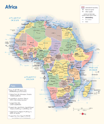
Mali is a landlocked country in Western Africa.  During the Scramble for Africa in the 19th century, Mali was conquered by the French.  But prior to the French invasion, Mali was part of one of the largest empires in Africa.  If you visit Mali, make sure to bring a guide that speaks French, as English speakers are hard to come by (although they are growing in number).  Here’s a Mali wall map. 


Mali may be classified as a developing country, but it is also home to 4 unique UNESCO World-Heritage sites.  Pays Dogon is one of these four sites.  Pays Dogon is a region in south-central Mali renowned for its numerous villages embedded into cliffs and mountainsides.  Some of these cliffs stand 500 meters high. 


The Dogon people have inhabited this region for nearly 1000 years and have developed their own religion, language, and culture.  Trekking this region gives you access to rare cultural experiences and breathtaking views, but it is strenuous.  Local villagers hike up mountain trails in sandals, often carrying heavy loads of clothing or food on their heads.  But they are experienced.  If you’re planning on hiking the mountain trails of Pays Dogon, bring good hiking shoes and plenty of supplies.  This trek can take anywhere from 2 to 10 days. 


If you’ve made this remarkable journey, or are planning to make it in the future, use a wall map to commemorate your achievement.  Trace your hiking path onto a wall map to see just how grand your accomplishment truly is.  Maps also make great mementos of vacations and travel destinations. 

Want to map a journey you’ve taken? Contact us!  mapsales.com carries over 200,000 wall maps…including national park and road wall maps! 


Click here for more maps of the world!


Wednesday, December 26, 2012

The 10 Best Treks in the World: The Inca Trail of Peru


 For all you hikers, backpackers, mountain climbers, and adventure-seekers out there, mapsales.com gives you the 10 best treks in the world.  Today, we look at The Inca Trail of Peru. 


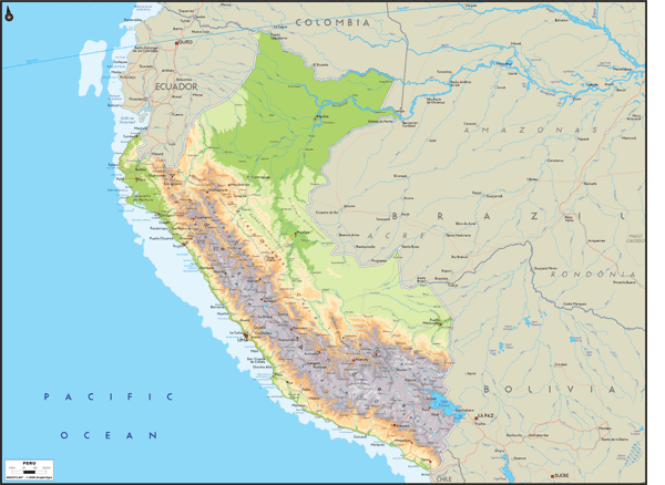
Peru Wall Map from mapsales.com

Though the Inca Trail may not be a particularly long trek, measuring only about 20 miles, its grandeur comes from its ancient status and its astonishing view.  It was created centuries ago by the Inca of Peru as a holy pilgrimage that prepared visitors to enter Machu Picchu.  


Today, the government only allows 500 people per day on the trail, and your spot has to be secured months in advance.  Hikers usually complete the trek in about 4-5 days.  Located in the Andes Mountains near the Peruvian city of Cusco, the Inca Trail gives hikers a unique view of Peru’s natural beauty.  Views of white-tipped mountains and high cloud forest combine with the magic of walking from one cliff-hugging ruin to the next – understandably making this South America’s most famous trail.


Though the trail may not be one of the longest hikes, it is strenuous.  The Inca Trail takes hikers up and down winding paths, usually climbing up a vertical mile from their starting point.  Dead Woman's Pass is the highest spot on the trail at 13,700 feet.  After passing an ancient stone viewing platform, which offers arguably the greatest view of the Andes in South America, you reach the dazzling white stone city of Machu Picchu. 


If you’ve made this remarkable trek, or are planning to make it in the future, use a map to commemorate the journey.  Trace your hiking path onto a wall map to see just how grand your accomplishment truly is.  Maps also make great mementos of vacations and travel destinations. 

Want to map a journey you’ve taken? Contact us!  mapsales.com carries over 200,000 wall maps…including national park and road wall maps! 


Click here for more maps of the world!